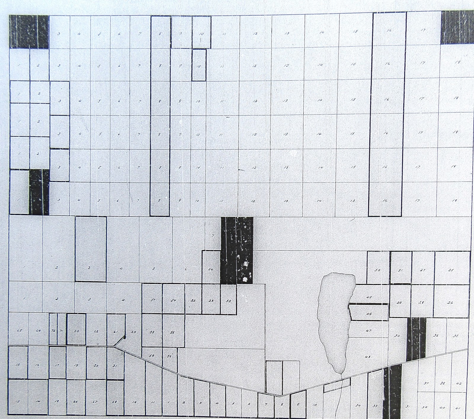
Map of Township 5 Range 5 - T5 R5 North of the Waldo Patent
This early map of the township that would become Ripley was created in 1780.
This copy is an update done in 1816 by Daniel Steward* who had been asked by the owners of the township to visit the settlers and create the mandatory "public lots".
*Daniel Steward Esq. Was a prominent early settler of Bloomfield, District
of Maine, Commonwealth of Massachusetts.
He settled in Central Maine in 1775.
He was born in Lunenburg, Massachusetts, in 1758, and settled in Milburn
in 1784. Bloomfield and Milburn were
early names for parts of the city of Skowhegan.
He was a veteran of the Revolutionary War. He did surveying work for the early proprietors
of the townships above the Waldo Patent. He served as treasurer of the
town. He died on September 15, 1840.
Here are close-ups of the writing and seal on the bottom of the map.
Transcript: “This plan represents Township No. 5 in the fifth range and was copeyed (sic) from a plan furnished me by Charles
Vaughn Esq. to which some necessary additions
are made by me in order to finish the several locations. By a scale of two inches to one mile. At the request of Gardiner L. Chandler &
John Merrick Esqre. I have
proceeded to make the following locations. viz. Those lots on this plan painted light Red
and containing in the whole 1280 acres are estimated to average in quality and
situation with the rest of the lands of said Township when they were in a state
of nature. Viz Lots No 1, 2 & 18 in
the first range. No. 2, in the sixth
range.
No. 8 Including two squares in the seventh range. No 13-14-32 & 43 on the Southerly side of
the Township. These were selected for
public uses for which they were reserved by the Commonwealth of Massachusetts.
“
Norridgewock Sept 3, 1816
Daniel
Steward
Transcript: “I herby certify that in making the location of Public lots in No 5 in
the 5th Range of
Townships. I had not the opportunity of
consulting the inhabitants in a body but the principal inhabitants in the South
East part of the Township being assembled at the house of William Hoyt the
Public lots in the centre and Easterly part of the Township were selected &
agreed to by them. also the Inhabitants
of the North West part of the township being assembled at the house of Mr.
Moses Leighton a part of the remainder of the public lots were selected and
agreed to by them.”
Norridgewock Sept 3, 1816
Daniel Steward
Here is a closer look at the map with the original
layout of lots.....
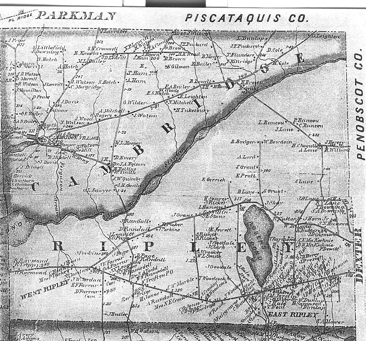
If you use Rogers Pond to orient yourself, it is easier to picture the township. Mainstream, the dividing line between the southern and northern parts is absent.....